
How Drone Surveying Is Changing Land Development in the Gulf Coast
The Gulf Coast is one of the fastest-growing regions in the United States. New residential communities, commercial developments, industrial facilities, road improvements, and coastal restoration projects are transforming the landscape every year. Before any of these projects can begin, developers, engineers, architects, and contractors rely on accurate land surveying to ensure every decision is based on precise data.
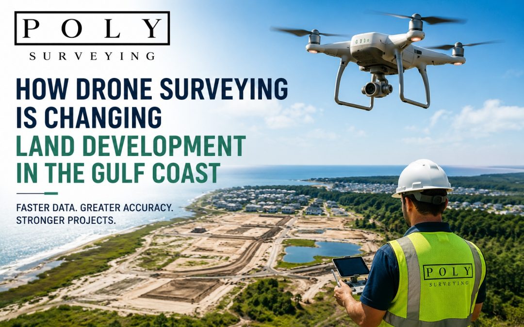
Today, one technology is revolutionizing the surveying industry—drone surveying.
By combining unmanned aerial vehicles (UAVs), advanced GPS technology, photogrammetry, and sophisticated mapping software, drone surveying allows surveyors to collect highly accurate information in a fraction of the time required by traditional methods.
At Poly Surveying, we combine cutting-edge drone technology with decades of professional surveying experience to deliver fast, reliable, and accurate survey data throughout Mobile, Baldwin County, and the Gulf Coast.
What Is Drone Surveying?
Drone surveying uses specialized unmanned aircraft equipped with high-resolution cameras and, in many cases, LiDAR sensors to capture thousands of aerial images of a property.
These images are processed into highly detailed digital products such as:
- Orthomosaic aerial maps
- Topographic maps
- 3D terrain models
- Digital elevation models
- Contour maps
- Volume calculations
- Construction progress reports
Unlike traditional aerial photography, drone surveying produces survey-grade data when combined with professional ground control points and GPS measurements.
Learn more about Poly Surveying’s Specialty Surveying Services:
https://polysurveying.com/specialty-services/
Why Drone Surveying Is Perfect for Gulf Coast Projects
The Gulf Coast presents unique surveying challenges.
Surveyors often work around:
- Marshes
- Wetlands
- Dense forests
- Large construction sites
- Waterfront property
- Industrial facilities
- Coastal restoration areas
Traditional field surveys may require crews to physically walk difficult terrain, sometimes taking several days to collect data.
Drone surveying dramatically reduces these challenges by capturing thousands of measurements from the air while minimizing time spent in hazardous environments.
For many projects, what once required multiple days of fieldwork can now be completed within hours.
Faster Data Collection Means Faster Development
Time is money in land development.
Developers, engineers, and contractors often work under tight schedules. Waiting days or weeks for site information can delay permitting, design work, and construction.
Drone surveying significantly accelerates the process by allowing survey teams to collect millions of data points during a single flight.
Benefits include:
- Faster project planning
- Reduced construction delays
- Quicker design revisions
- More efficient site inspections
- Improved communication between project teams
The result is a smoother development process from concept through construction.
Exceptional Accuracy for Better Decisions
Speed means little without accuracy.
Modern survey drones use RTK (Real-Time Kinematic) GPS technology and professionally established control points to produce highly accurate survey data suitable for engineering and construction applications.
Developers can confidently use drone-generated information for:
- Site grading
- Drainage design
- Utility planning
- Earthwork calculations
- Infrastructure design
- Environmental assessments
Professional land surveyors verify and process this data to ensure it meets project requirements.
Learn more about the different survey services offered by Poly Surveying:
https://polysurveying.com/types-of-surveys/
Improved Safety on Challenging Job Sites
One of the greatest advantages of drone surveying is improved worker safety.
Rather than sending crews into hazardous locations, drones safely collect data from above.
This is especially valuable when surveying:
- Busy highways
- Bridges
- Active construction sites
- Flood-prone areas
- Steep embankments
- Industrial plants
- Coastal marshes
Reducing field exposure lowers risk while still producing comprehensive survey information.
Better Planning Through 3D Mapping
Modern land development depends on visualization.
Drone-generated 3D models allow developers, architects, engineers, and property owners to view a project before construction even begins.
These models help identify:
- Drainage concerns
- Elevation changes
- Vegetation
- Existing structures
- Access roads
- Utility corridors
- Site constraints
Having a complete digital representation of the property helps teams make better decisions early in the planning process.
Drone Surveying Supports Coastal Resilience
The Gulf Coast faces unique environmental conditions, including hurricanes, flooding, erosion, and changing shorelines.
Drone surveying provides valuable information for:
- Coastal restoration
- Storm damage assessments
- Floodplain analysis
- Shoreline monitoring
- Wetland management
These detailed surveys help engineers and government agencies develop more resilient infrastructure while protecting natural resources.
For information about FEMA flood mapping and flood risk, visit:
https://www.fema.gov
Construction Progress Monitoring
Drone surveying isn’t just valuable before construction—it continues providing benefits throughout the entire project.
Regular drone flights allow developers to:
- Track construction progress
- Measure earthmoving quantities
- Compare work against project plans
- Document milestones
- Improve communication with stakeholders
These aerial updates provide an accurate historical record of every stage of construction.
Cost Savings Across the Entire Project
Drone surveying often reduces overall project costs by improving efficiency and minimizing delays.
Potential savings include:
- Reduced field labor
- Faster project completion
- Fewer return site visits
- More accurate earthwork estimates
- Better planning decisions
- Lower project risk
Although every project is different, many developers find that drone surveying pays for itself through improved productivity.
Why Choose Poly Surveying?
Technology alone doesn’t create accurate surveys.
Professional expertise remains essential.
At Poly Surveying, our licensed surveyors combine years of experience with the latest drone technology to provide dependable results for projects throughout Mobile, Baldwin County, and the Gulf Coast.
Whether you’re developing residential property, commercial sites, industrial facilities, or public infrastructure, our team delivers the accurate data needed to move your project forward with confidence.
Contact Poly Surveying today to learn how drone surveying can improve your next land development project.
https://polysurveying.com/contact/
Frequently Asked Questions
Is drone surveying as accurate as traditional surveying?
Yes. When performed by licensed professionals using RTK GPS, ground control points, and proper processing techniques, drone surveys provide highly accurate data suitable for many engineering and development applications.
What types of projects benefit from drone surveying?
Residential developments, commercial construction, industrial sites, highways, utility corridors, coastal restoration, mining, agriculture, and infrastructure projects all benefit from drone surveying.
Is drone surveying faster than traditional methods?
In many cases, yes. Large properties that might require several days of conventional fieldwork can often be documented in just a few hours using drone technology.
Can drone surveying help after hurricanes?
Absolutely. Drones quickly document storm damage, shoreline changes, flooding, erosion, and debris while keeping survey crews out of dangerous areas.
Does Poly Surveying provide drone surveying throughout the Gulf Coast?
Yes. Poly Surveying provides professional drone surveying and land surveying services throughout Mobile, Baldwin County, and surrounding Gulf Coast communities.
Recent Comments