

Subdivision of Land or Platting (Major vs. Minor)
Subdivision of land (commonly referred to as subdivision platting) is the process of splitting a tract of land into smaller parcels and is reviewed by the governmental agency that oversees this process. There are two forms of subdivision being major subdivision and minor subdivision with minor typically being 5 lots or less and Major typically involving the construction of a roadway for either Public or Private use. The complexity of each form typically depends to the jurisdiction reviewing as each has independent rules and requirements that must be met. All major subdivisions have a topographic survey involved to provide elements needs for design of roadway, drainage and utilities to provide access for the subdivision itself.
Our Drone division aides in the process to ensure timely delivery of the topographic survey for both design and overall planning, while providing an accurate boundary survey to provide the framework for the overall design and layout of planned lots. Polysurveying provides speed and accuracy to the engineer performing the design to ensure that the developer gets his or her plans into a design phase much faster than use of older traditional methods of cutting line or brush cutting which is time consuming and not cost effective. Lastly, the platting process to provide an overall layout map that shows building setbacks, easements, wetlands, and other features is produced to allow the developer to sell lots once recorded into the court records. The completion of this process allows the developer to begin to sell lots and provide future homesites for builders and buyers alike.
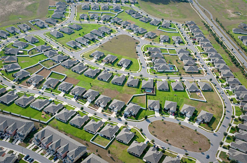
At Polysurveying, we pride ourselves on making your subdivision whether major or minor a success to ensure your project gets from start to finish in the most efficient and effective way possible.
Reach Out Today
Before you start construction on a new home, building, addition, or fence, contact Polysurveying. We will confirm your boundary lines and the full extent of your land. That way, you avoid surprises later.
Our team is highly trained and shares years of experience. We also stay current with industry updates and new technology. As a result, we can make defining your property lines a breeze.
We are based in Mobile, Alabama. However, we also serve Baldwin County, the Gulf Coast, and Hancock, Harrison, and Jackson Counties in Mississippi. We offer free estimates, so you won't face hidden costs.
Use our contact form or call us at (251) 666-2010. Tell us about your project and ask about payment options. We will help you buy, sell, build, or simply enjoy your land with clear property lines.
Get a Free Quote
Polysurveying handles land surveying jobs and projects in Alabama, Florida, Mississippi, and Georgia. We provide free quotes to anyone who needs land surveying services.

Corporate Office
5588 Jackson Rd
Mobile, AL 36619
(251) 666-2010
Alabama Field Offices
Baldwin County: (251) 626-0905
Montgomery: (334) 245-5721
Birmingham: (205) 582-1040
Florida Field Offices
Pensacola: (850) 696-1661
Defuniak Springs: (850) 790-0045
Tallahassee: (448) 488-0585
Jacksonville: (904) 312-7095
Orlando: (407) 495-1260
Mississippi Field Offices
Ocean Springs: (228) 215-8749
Jackson: (601) 414-2534
HOURS
Mon 8AM - 5PM
Tue 8AM - 5PM
Wed 8AM - 5PM
Thur 8AM - 5PM
Fri 8AM- 4PM
Disclaimer: All survey work performed by field divisions is in responsible charge at direction of the Corporate office. All research, assignment, coordination, drafting, billing and review are completed out of the Corporate office.