
Drone Surveying vs Traditional Land Surveying: Which Method Is Best?
Drone surveying services and traditional land surveying both play important roles in construction, development, and property planning. Understanding Drone Surveying vs Traditional Land Surveying helps business owners choose the right solution for project accuracy, efficiency, safety, and cost.
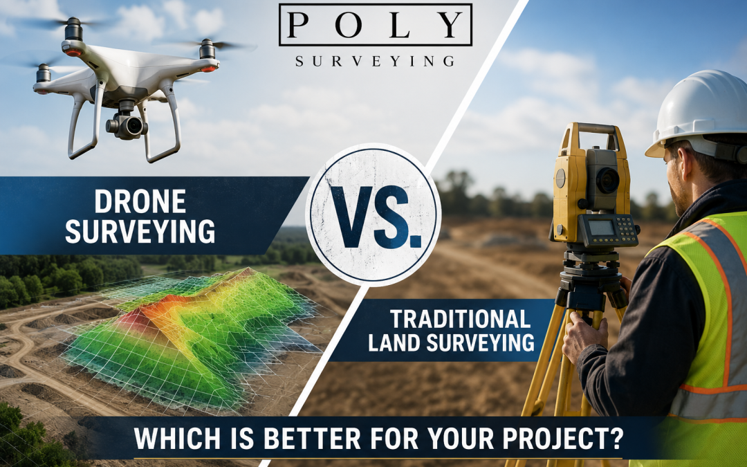
Modern drone technology allows surveyors to collect aerial data faster than ever before. At the same time, traditional surveying methods remain essential for legal documentation and high-precision engineering work.
In this guide, we compare both methods to help you determine the right option for your next project.
What Is Drone Surveying?
Drone surveying uses unmanned aerial vehicles (UAVs) equipped with cameras, GPS systems, and mapping software to capture geographic data from above.
Surveyors use drone technology to create:
- Orthomosaic maps
- 3D models
- Elevation reports
- Site measurements
- Topographic maps
Drone technology is commonly used for:
- Construction site mapping
- Land development
- Mining operations
- Roofing inspections
- Infrastructure projects
- Commercial property surveying
According to the Federal Aviation Administration, commercial drone usage continues to expand rapidly across construction and engineering industries.
Because drones can survey large areas quickly, businesses often reduce labor costs and improve turnaround times.
What Is Traditional Land Surveying?
Traditional land surveying uses ground-based tools and manual measurements to establish property boundaries, elevations, and site layouts.
Surveyors commonly use:
- Total stations
- GPS receivers
- Levels
- Measuring instruments
Traditional surveying is often required for:
- Legal boundary surveys
- Property line verification
- Municipal approvals
- Engineering projects
- Construction staking
Many firms offering professional land surveying services also provide topographic surveys for commercial and residential developments.
Comparing Speed and Efficiency
One major difference between aerial and ground surveying methods is project speed.
Drone surveys can often be completed in just a few hours, while traditional field surveys may require several days depending on terrain and project size.
For companies operating under tight deadlines, drone mapping services provide a major efficiency advantage.
The faster workflow also reduces interruptions on active job sites.
Comparing Accuracy and Precision
Traditional surveying remains the industry standard for legal-grade measurements.
However, modern drone systems using RTK and GPS correction technology can achieve highly accurate results for many commercial applications.
Construction companies often combine aerial surveying with ground-based land surveying to improve both speed and precision.
According to the American Society of Civil Engineers, advanced surveying technologies continue improving project efficiency and planning accuracy.
Cost Differences Between Surveying Methods
Project cost is another important factor when evaluating different surveying methods.
Drone-based mapping often lowers costs because it reduces:
- Labor requirements
- Field crew sizes
- Site visits
- Manual data collection
Traditional surveys may become more expensive when projects involve difficult terrain or large commercial properties.
Businesses managing commercial development projects frequently use aerial mapping to improve efficiency and reduce operational expenses.
Safety Benefits of Drone Mapping
Safety is one of the biggest advantages of modern aerial surveying.
Traditional crews may need to work in:
- Busy roadways
- Construction zones
- Industrial facilities
- Uneven terrain
Drone technology allows surveyors to collect data remotely without exposing workers to hazardous conditions.
This makes drone systems especially useful for construction monitoring and infrastructure inspections.
When Traditional Surveying Is the Better Choice
Although drones offer many benefits, traditional surveying methods remain essential for certain projects.
Ground-based surveys are typically preferred for:
Legal Boundary Documentation
Municipalities and courts often require certified land surveys for legal purposes.
Engineering and Design Projects
Some engineering applications demand extremely detailed measurements obtained through traditional equipment.
Dense Vegetation Areas
Heavy tree coverage can reduce aerial visibility and limit drone effectiveness.
Permit and Compliance Requirements
Certain jurisdictions still require conventional survey documentation for approvals and permitting.
Working with an experienced surveying company helps ensure compliance with local regulations.
When Drone Technology Works Best
Drone mapping is ideal when businesses need:
- Fast turnaround times
- Large-area mapping
- Progress tracking
- Earthwork calculations
- High-resolution aerial imagery
- Site inspections
Companies using professional drone surveying services often improve project planning while reducing delays.
Frequently Asked Questions
Is drone surveying more affordable?
In many cases, yes. Drone surveying reduces labor time and speeds up data collection for larger projects.
Can drones replace traditional surveyors?
No. Licensed surveyors are still required for legal documentation and engineering work.
What industries use drone surveying?
Construction, agriculture, mining, infrastructure, and real estate industries frequently use aerial surveying technology.
Are drone surveys accurate?
Modern RTK drone systems provide highly accurate data for many construction and mapping applications.
Ready to Plan Your Next Project?
Choosing the right surveying solution can improve project accuracy, safety, and efficiency.
Whether you need drone surveying services, traditional land surveying, or a hybrid approach, our experienced team can help you find the right solution.
Contact us today to discuss your upcoming project and learn more about our surveying services.
Recent Comments